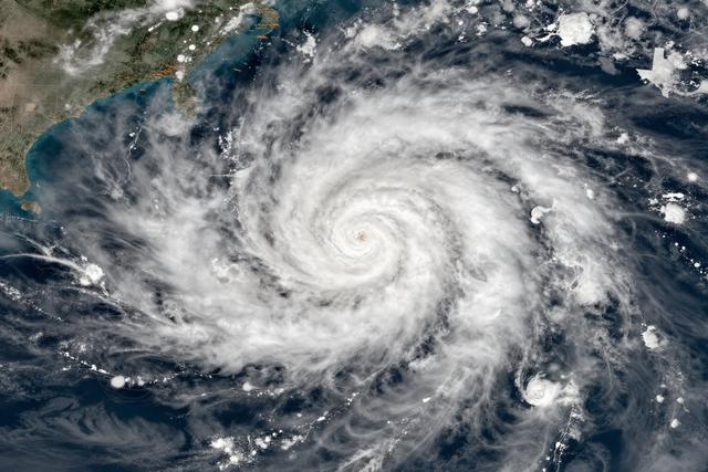
Texas weather forecasters are keeping a close eye on Hurricane Polo, a large tropical system developing off the Pacific coast of Mexico, as the storm gains strength on September 25, 2026. The storm’s size and recent intensification have prompted officials in the Lone Star State to monitor its progress closely, even though the cyclone remains well offshore.
The National Weather Service office in Houston and the Texas State Meteorological Center have activated standard observation protocols, employing satellite imagery, ocean buoys, and computer models to track Polo’s movement. Analysts are reviewing the storm’s projected path to assess any potential influence on Gulf Coast weather patterns, including the possibility of increased moisture or peripheral wind shifts that could affect the state’s eastern regions.
Polo is classified as a Pacific hurricane, a type of storm that forms over the warm waters of the eastern Pacific and can occasionally affect weather farther north and east. While the system is still situated off Mexico’s coastline, its broad circulation and recent strengthening have raised questions about whether its outer bands might reach as far as southern Texas. At this stage, forecasters emphasize that no direct impact is expected, but they remain vigilant for any changes that could alter the storm’s trajectory.
The monitoring effort reflects a broader practice of tracking tropical cyclones that, even when distant, can modify regional atmospheric conditions. By maintaining real‑time surveillance, Texas officials aim to provide timely information to emergency managers and the public should the storm’s influence expand. The agencies will continue to issue updates as new data become available, ensuring that any shift in Polo’s behavior is promptly communicated.
In summary, Texas weather services are actively observing Hurricane Polo as it intensifies off Mexico’s Pacific coast, ready to respond should the storm’s effects extend toward the state.