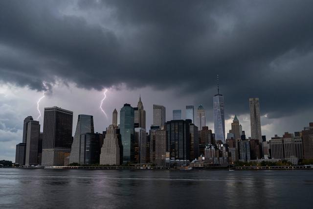
The National Weather Service announced a severe thunderstorm watch for New York City and the surrounding Tri‑State region on Friday, August 7, 2026. The watch remains in effect until 9:00 p.m. local time, covering the remainder of the afternoon and early evening.
A severe thunderstorm watch indicates that atmospheric conditions are favorable for the development of storms capable of producing damaging winds, large hail, and frequent lightning. Unlike a warning, which is issued when a hazardous storm is imminent or occurring, a watch serves as an early alert, urging residents and commuters to stay informed and be ready to act should conditions deteriorate.
The National Weather Service typically issues watches when meteorologists identify a combination of moisture, instability, and wind shear that could spawn organized thunderstorms. In this case, the forecast models pointed to sufficient moisture and lift across the metropolitan area, raising the likelihood of storms that could reach the criteria for severity.
Authorities recommend that anyone outdoors keep an eye on updates from local news, weather apps, or the NWS website. Those driving should allow extra travel time and be prepared for sudden reductions in visibility due to heavy rain or lightning. Residents are advised to secure loose items outdoors, such as patio furniture or garden tools, which could become projectiles in strong gusts.
While the watch does not guarantee that severe storms will materialize, it signals that conditions are ripe for potentially hazardous weather. The public should remain vigilant, especially in neighborhoods prone to flash flooding or where trees are close to power lines. As the forecast evolves, the National Weather Service may issue more specific warnings if storms become imminent.
By staying alert and following recommended safety precautions, New Yorkers can reduce the risk of injury or property damage should severe thunderstorms develop before the watch expires at 9:00 p.m.