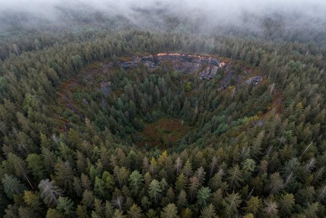
In 2024, Joël Lapointe, a resident of Quebec’s Côte‑Nord region, identified a circular depression on satellite images that turned out to be a previously unknown meteor impact crater. The feature, located in the Côte‑Nord area of Quebec, Canada, measures as a distinct round basin that scientists say was created by a meteor strike roughly 390 million years ago. Lapointe first noticed the shape while examining Google Maps imagery of his surroundings, recognizing the symmetry that suggested an impact origin. Subsequent review confirmed that the depression had not been recorded in any existing geological or planetary impact databases, making it the first documented crater of this age in the region.
The discovery adds a new point of interest to the list of known impact structures in Canada, a country already home to several ancient craters. Although the exact dimensions of the basin have not yet been published, the identification of the site provides researchers with a fresh location to study the effects of Paleozoic‑era impacts on the local geology. The age of the crater, estimated at 390 million years, places its formation in the Devonian period, a time when marine life was diversifying and early terrestrial ecosystems were developing.
Local authorities have been notified of the find, and provincial geological services are expected to conduct field examinations to verify the impact hypothesis and to map the structure in detail. The use of publicly available satellite imagery demonstrates how citizen observations can contribute to scientific knowledge, especially in remote or sparsely surveyed regions. Lapointe’s observation underscores the value of digital mapping tools for uncovering hidden natural features that have escaped detection by traditional surveys.