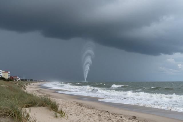
A tornado made landfall on Cape May Point beach in Cape May County on Tuesday, July 21, 2026, according to the National Weather Service. The event occurred while a tornado warning was already active for the area, as severe storms moved through the region.
The National Weather Service confirmed that the vortex touched down directly on the sandy shoreline, marking a rare occurrence for the coastal community. Prior to the touchdown, a waterspout was observed offshore and captured on video, illustrating the progression of the rotating column of air from water to land.
Officials noted that the tornado warning had been issued in advance of the storm, providing residents and beachgoers with a brief window to seek shelter. The warning was part of standard protocol for severe weather systems that were advancing across the Mid-Atlantic and New Jersey coastline on Tuesday.
The waterspout, visible in the video footage, demonstrated the classic funnel shape associated with such phenomena before it transitioned onto land. The National Weather Service used radar and spotter reports to track the storm’s development and to issue the warning that preceded the touchdown.
Cape May Point beach, a popular destination for tourists and locals, experienced the brief but intense event without any additional details on damage or injuries being released at the time of reporting. Emergency responders were on standby as the storm moved through the area, and the National Weather Service continued to monitor the situation throughout the evening.
The incident underscores the unpredictable nature of severe weather in coastal regions, especially when waterspouts can evolve into land‑based tornadoes under the right conditions. Residents are reminded to stay alert to weather alerts and to follow guidance from local authorities during future severe weather events.